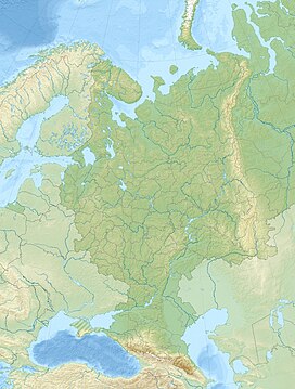
| Yergeni | |
|---|---|
| Ергени / Ergnin җirn zurһan shiir | |
 Landscape of the hills | |
| Highest point | |
| Peak | Shared |
| Elevation | 222 m (728 ft)[1] |
| Coordinates | 46°19′N 44°16′E / 46.317°N 44.267°E[1] |
| Dimensions | |
| Length | 350 km (220 mi) N/S |
| Width | 50 km (31 mi) E/W |
| Geography | |
| Location | East European Plain (Kalmykia, Volgograd Oblast, Rostov Oblast, Russia) |
| Geology | |
| Rock type(s) | Sand, clay, limestone and sandstone |
| Climbing | |
| Easiest route | From Elista |
Yergeni (Ергени; Oirat: Ergnin җirn zurһan shiir) is a hilly area in Russia. It is located in the southern corner of the East European Plain, mostly in Kalmykia, with parts in Volgograd Oblast and Rostov Oblast. The highest point of Kalmykia, 222 metres (728 ft) high Shared, is located in the Yergeni hills.[1]
In Kalmykia the hills stretch from Sarpinsky District to the north to Iki-Burulsky District in the south.
- ^ a b c Google Earth


