Village of Ymir | |
|---|---|
Unincorporated Community | |
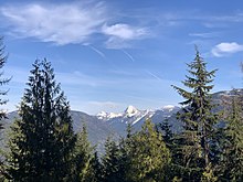
 Ymir and the Salmo River from Wildhorse Mountain | |
| Coordinates: 49°17′N 117°13′W / 49.283°N 117.217°W | |
| Country | |
| Province | |
| Regional District | Central Kootenay |
| Region | West Kootenay |
| Traditional Territory of | Ktunaxa Peoples (Kootenay) |
| First Settled | 1886 |
| Townsite Laid Out | 1897 |
| Government | |
| Area | |
| • Total | 1.09 km2 (0.42 sq mi) |
| Elevation | 730 m (2,395 ft) |
| Population (2016) | |
| • Total | 245 |
| • Density | 224.7/km2 (582/sq mi) |
| Time zone | PST |
| Area code(s) | 250, 778, 236, & 672 |
| Highways | |
| Website | Ymir |


Ymir /ˈwaɪmər/ is a village in the Selkirk Mountains in the West Kootenay region of southeastern British Columbia. Ymir is located where the Salmo River meets Quartz Creek, and Ymir Creek.[1] The locality, on BC Highway 6, is by road about 10 kilometres (6 mi) northeast of Salmo and 34 kilometres (21 mi) south of Nelson.
