Yolo County, California | |
|---|---|
| County of Yolo | |
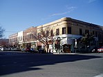
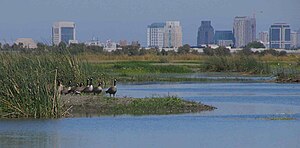
Images, from top down, left to right: The former Yolo County Courthouse in Woodland, The Ziggurat in West Sacramento, Mondavi Center on the UC Davis campus, Downtown Winters, Canada Geese at the Yolo Bypass Wildlife Area | |
 Interactive map of Yolo County | |
 Location in the state of California | |
| Coordinates: 38°33′14″N 121°44′17″W / 38.55389°N 121.73806°W | |
| Country | United States |
| State | California |
| Region | Sacramento Valley |
| CSA | Greater Sacramento |
| Incorporated | February 18, 1850[1] |
| County seat | Woodland |
| Largest city | Davis (population) West Sacramento (area) |
| Government | |
| • Type | Council–CAO |
| • Body | Board of Supervisors |
| • Chair | Oscar Villegas |
| • Vice Chair | Lucas Frerichs |
| • Board of Supervisors[2] | Supervisors
|
| • Chief Administrative Officer | Gerardo Pinedo |
| Area | |
| • Total | 1,024 sq mi (2,650 km2) |
| • Land | 1,015 sq mi (2,630 km2) |
| • Water | 8.9 sq mi (23 km2) |
| Highest elevation | 3,123 ft (952 m) |
| Population | |
| • Total | 216,403 |
| • Density | 210/sq mi (82/km2) |
| GDP | |
| • Total | $18.735 billion (2022) |
| Time zone | UTC-8 (Pacific Time Zone) |
| • Summer (DST) | UTC-7 (Pacific Daylight Time) |
| Area codes | 530, 916, 279 |
| FIPS code | 06-113 |
| GNIS feature ID | 277321 |
| Congressional districts | 4th, 7th |
| Website | www |
Yolo County (/ˈjoʊloʊ/ ; Wintun: Yo-loy), officially the County of Yolo, is a county located in the northern portion of the U.S. state of California. Yolo County was one of the original counties of California, created in 1850 at the time of statehood. As of the 2020 census, the population was 216,403.[4][6] Its county seat is Woodland.[7]
Yolo County is included in the Greater Sacramento metropolitan area and is located in the Sacramento Valley.
- ^ "Chronology". California State Association of Counties. Archived from the original on January 29, 2016. Retrieved February 6, 2015.
- ^ "Board of Supervisors | Yolo County".
- ^ "Little Blue Ridge". Peakbagger.com. Retrieved February 5, 2015.
- ^ a b "Quick Facts - Yolo County, CA". United States Census Bureau. Retrieved December 19, 2021.
- ^ "Gross Domestic Product: All Industries in Yolo County, CA". Federal Reserve Economic Data. Federal Reserve Bank of St. Louis.
- ^ "Yolo County, California". United States Census Bureau. Retrieved January 30, 2022.
- ^ "Find a County". National Association of Counties. Archived from the original on May 31, 2011. Retrieved June 7, 2011.


