Miho Airbase 美保飛行場 Yonago Airport (米子空港) | |||||||||||
|---|---|---|---|---|---|---|---|---|---|---|---|
 | |||||||||||
| Summary | |||||||||||
| Airport type | Public / Military | ||||||||||
| Operator | JASDF | ||||||||||
| Serves | Yonago, Tottori, Japan | ||||||||||
| Elevation AMSL | 13 ft / 4 m | ||||||||||
| Coordinates | 35°29′36″N 133°14′21″E / 35.49333°N 133.23917°E | ||||||||||
| Map | |||||||||||
 | |||||||||||
| Runways | |||||||||||
| |||||||||||
| Statistics (2015) | |||||||||||
| |||||||||||
Source: Japanese Ministry of Land, Infrastructure, Transport and Tourism[1] | |||||||||||
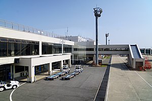
Miho Airbase (美保飛行場) (IATA: YGJ, ICAO: RJOH), also known as Yonago Airport and Yonago Kitaro Airport is a Japan Air Defense Force (JASDF) base located 11 km northwest of Yonago in Tottori Prefecture. It is owned and operated by JASDF and shares the runway with civil activities.
- ^ "Miho-Yonago Airport" (PDF). Japanese Ministry of Land, Infrastructure, Transport and Tourism. Archived from the original (PDF) on 21 October 2016. Retrieved 7 January 2017.

