| Yorketown South Australia | |||||||||||||||
|---|---|---|---|---|---|---|---|---|---|---|---|---|---|---|---|
 Meville Hotel, Yorketown | |||||||||||||||
| Coordinates | 35°01′14″S 137°36′10″E / 35.020683°S 137.602782°E[1] | ||||||||||||||
| Population | 667 (UCL 2021)[2] | ||||||||||||||
| Established | 1872 (sub-division) 27 May 1999 (locality)[1][3][4] | ||||||||||||||
| Postcode(s) | 5576[5] | ||||||||||||||
| Time zone | ACST (UTC+9:30) | ||||||||||||||
| • Summer (DST) | ACST (UTC+10:30) | ||||||||||||||
| Location | |||||||||||||||
| LGA(s) | Yorke Peninsula Council | ||||||||||||||
| Region | Yorke and Mid North[1] | ||||||||||||||
| County | Fergusson[1] | ||||||||||||||
| State electorate(s) | Narungga[6] | ||||||||||||||
| Federal division(s) | Grey[7] | ||||||||||||||
| |||||||||||||||
| |||||||||||||||
| Footnotes | LGA[1] Adjoining localities[1] | ||||||||||||||
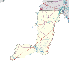
Yorketown is a town and a locality in the Australian state of South Australia located in the southern Yorke Peninsula about 91 kilometres (57 mi) west of the state capital of Adelaide and about 70 kilometres (43 mi) south of the municipal seat of Maitland.[1][5]
- ^ a b c d e f g h "Search results for 'Yorketown, LOCB' with the following datasets being selected – 'Suburbs and Localities', 'Counties', 'Hundreds', 'Local Government Areas', 'SA Government Regions', 'Land Development Plan Zone Categories' and 'Gazetteer'". Location SA Map Viewer. Government of South Australia. Retrieved 18 August 2018.
- ^ Australian Bureau of Statistics (28 June 2022). "Yorketown (urban centre and locality)". Australian Census 2021.
- ^ Manning, Geoffrey H. (2012). "Search results for 'Yorketown'" (PDF). A Compendium of the Place Names of South Australia From Aaron Creek to Zion Hill With 54 Complementary Appendices Researched and written by Geoffrey H. Manning. Geoffrey H. Manning. Retrieved 10 March 2018.
- ^ Kentish, P.M. (27 May 1999). "GEOGRAPHICAL NAMES ACT 1991 Notice to Assign Boundaries and Names to Places (in the District Council of Yorke Peninsula)" (PDF). The South Australian Government Gazette. South Australian government. p. 2696. Retrieved 18 August 2018.
- ^ a b c "Yorketown, South Australia (Postcode)". postcodes-australia.com. Retrieved 18 August 2018.
- ^ Narungga (Map). Electoral District Boundaries Commission. 2016. Retrieved 1 March 2018.
- ^ "Federal electoral division of Grey". Australian Electoral Commission. Retrieved 18 August 2018.
- ^ a b c "Monthly climate statistics: Summary statistics EDITHBURGH". Commonwealth of Australia, Bureau of Meteorology. Retrieved 10 March 2018.
