 Aerial view of Yoronjima in 2008 | |
 | |
| Geography | |
| Location | East China Sea |
| Coordinates | 27°22′08″N 128°34′00″E / 27.36889°N 128.56667°E |
| Archipelago | Amami Islands |
| Area | 20.8 km2 (8.0 sq mi) |
| Coastline | 23.5 km (14.6 mi) |
| Highest elevation | 98 m (322 ft) |
| Administration | |
Japan | |
| Prefectures | Kagoshima Prefecture |
| District | Ōshima District |
| Demographics | |
| Population | 6,000 (2013) |
| Ethnic groups | Ryukyuan, Japanese |
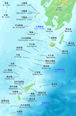
Yoronjima (与論島, Okinawan and Yoron: ユンヌ Yunnu; Okinoerabu: ユーヌ Yuunu, archaic Northern Ryukyuan: かゑふた Kawefuta), also known as Yoron, is one of the Amami Islands.[1]
The island, 20.8 km2 (8 sq. mi.) in area, has a population of approximately 6,000 people, and is administered as the town of Yoron, Kagoshima. Much of the island is within the borders of the Amami Guntō National Park.
- ^ Teikoku's Complete Atlas of Japan, Teikoku-Shoin Co., Ltd., Tokyo, ISBN 4-8071-0004-1