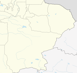
Yuli County
Yülihsien, Lopnur | |
|---|---|
 | |
 Yuli County (red) within Bayingolin Prefecture (yellow) and Xinjiang | |
| Coordinates: 41°20′38″N 86°15′40″E / 41.344°N 86.261°E | |
| Country | China |
| Autonomous region | Xinjiang |
| Autonomous prefecture | Bayingolin |
| County seat | Yuli (Lopnur) |
| Area | |
| • Total | 59,401.78 km2 (22,935.16 sq mi) |
| Population (2020)[3] | |
| • Total | 101,866 |
| • Density | 1.7/km2 (4.4/sq mi) |
| Ethnic groups | |
| • Major ethnic groups | Han Chinese, Uyghur[4] |
| Time zone | UTC+8 (China Standard[a]) |
| Postal code | 841500 |
| Website | yuli |
| Yuli County | |||||||||||
|---|---|---|---|---|---|---|---|---|---|---|---|
| Chinese name | |||||||||||
| Simplified Chinese | 尉犁县 | ||||||||||
| Traditional Chinese | 尉犁縣 | ||||||||||
| |||||||||||
| Alternative Chinese name | |||||||||||
| Simplified Chinese | 罗布淖尔县 | ||||||||||
| Traditional Chinese | 羅布淖爾縣 | ||||||||||
| |||||||||||
| Second alternative Chinese name | |||||||||||
| Simplified Chinese | 罗布泊县 | ||||||||||
| Traditional Chinese | 羅布泊縣 | ||||||||||
| |||||||||||
| Mongolian name | |||||||||||
| Mongolian script | ᠯᠣᠪ ᠨᠠᠭᠤᠷ ᠰᠢᠶᠠᠨ | ||||||||||
| Uyghur name | |||||||||||
| Uyghur | لوپنۇر ناھىيىسى | ||||||||||
| |||||||||||
Yuli County as the official Romanized name, also transliterated from Mongolian as Lopnur County (Lop Nur), is a county in the Xinjiang Uyghur Autonomous Region and is under the administration of the Bayin'gholin Mongol Autonomous Prefecture. It contains an area of 59,399 km2 (22,934 sq mi). According to the 2002 census, it has a population of 100,000.
- ^ Cite error: The named reference
govylwas invoked but never defined (see the help page). - ^ Cite error: The named reference
xzqhylwas invoked but never defined (see the help page). - ^ Xinjiang: Prefectures, Cities, Districts and Counties
- ^ 1997年尉犁县行政区划 [1997 Yuli County Administrative Divisions]. XZQH.org. 10 December 2010. Retrieved 4 April 2020.
面积59760.8平方千米,人口9万,有汉、维吾尔、蒙古、满等民族,其中汉族占70.2%{...}其中维吾尔族占90.1%
Cite error: There are <ref group=lower-alpha> tags or {{efn}} templates on this page, but the references will not show without a {{reflist|group=lower-alpha}} template or {{notelist}} template (see the help page).


