This article needs additional citations for verification. (August 2013) |
Yulin
Watlam | |
|---|---|
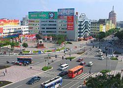
 Yulin in 2006 | |
 Location of Yulin City jurisdiction in Guangxi | |
| Coordinates (Yulin municipal government): 22°39′14″N 110°10′52″E / 22.654°N 110.181°E | |
| Country | People's Republic of China |
| Autonomous region | Guangxi |
| Municipal seat | Yuzhou District |
| Area | |
| 12,828 km2 (4,953 sq mi) | |
| • Urban | 1,237 km2 (478 sq mi) |
| • Metro | 3,689.4 km2 (1,424.5 sq mi) |
| Population (2020 census)[1] | |
| 5,796,766 | |
| • Density | 450/km2 (1,200/sq mi) |
| • Urban | 1,226,830 |
| • Urban density | 990/km2 (2,600/sq mi) |
| • Metro | 2,438,467 |
| • Metro density | 660/km2 (1,700/sq mi) |
| GDP[2] | |
| • Prefecture-level city | CN¥ 207.1 billion US$ 32.1 billion |
| • Per capita | CN¥ 35,639 US$ 5,524 |
| Time zone | UTC+8 (China Standard) |
| Postal code | 537000 |
| Area code | 0775 |
| ISO 3166 code | CN-GX-09 |
| Website | yulin |
Yulin (Chinese: 玉林; pinyin: Yùlín; lit. 'Jade Forest', 鬱林), alternately romanized as Watlam, is one of the fourteen prefecture-level cities of the Guangxi Zhuang Autonomous Region, People's Republic of China. Its Chinese name was changed in 1956 from the historical name "鬱林" (pinyin: Yùlín; lit. 'Dense Forest'), which is homophonous in Standard Mandarin, but different in the local dialect of Yue Chinese; "鬱" is [uat˥] while "玉" is [ȵok˨]. The former romanization follows the pronunciation of the historical name in Yue Chinese. Its built-up area is made of two urban districts, and Beiliu City was home to 2,438,467 inhabitants as of 2020 census.