Yuma, Arizona | |
|---|---|
|
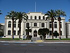
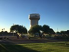
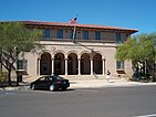
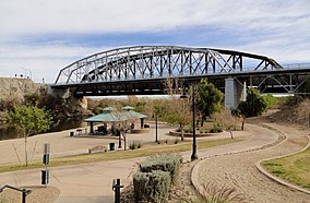
Clockwise from top: Old Yuma City Hall, Yuma Theatre, Old Yuma Post Office, Ocean to Ocean Bridge, Yuma water tower, Yuma County Courthouse | |
 Location of Yuma in Yuma County, Arizona | |
| Coordinates: 32°40′00″N 114°34′20″W / 32.66667°N 114.57222°W | |
| Country | United States |
| State | Arizona |
| County | Yuma |
| Incorporated | 1914 |
| Government | |
| • Type | Council-Manager |
| • Body | Yuma City Council |
| Area | |
| • City | 120.84 sq mi (312.97 km2) |
| • Land | 120.77 sq mi (312.79 km2) |
| • Water | 0.07 sq mi (0.18 km2) 0.07% |
| Elevation | 256 ft (78 m) |
| Population (2020) | |
| • City | 95,548 |
| • Density | 791.18/sq mi (305.47/km2) |
| • Urban | 135,717 (US: 253rd) |
| • Metro | 203,247 (US: 214th) |
| Demonym | Yuman |
| Time zone | UTC−7 (MST) |
| ZIP codes | 85364–85367, 85369, 85350 |
| Area code | 928 |
| FIPS code | 04-85540 |
| GNIS ID | 2412328[2] |
| Major airport | Yuma International Airport |
| Website | www.yumaaz.gov |
Yuma is a city in and the county seat[3] of Yuma County, Arizona, United States. The city's population was 95,548 at the 2020 census, up from the 2010 census population of 93,064.[4]
Yuma is the principal city of the Yuma, Arizona, Metropolitan Statistical Area, which consists of Yuma County. According to the United States Census Bureau, the 2020 estimated population of the Yuma MSA is 203,247.[5] According to Guinness World Records, Yuma is the "Sunniest City on Earth," promising "sunshine and warm weather at least 91% of the year."[6] Anywhere from 70,000 to over 85,000 out-of-state visitors make Yuma their winter residence.[7]
Yuma's weather also makes it an agricultural powerhouse, growing over 175 types of crops, the largest of which is lettuce. Yuma County provides 90% of all leafy vegetables grown from November to March in the United States.[8][9] Yuma is also known for its large military population due to several military bases, including the Marine Corps Air Station.
Yuma is in the state's southwestern corner, in the Sonoran Desert, Yuma Desert sub-region.
- ^ "2020 U.S. Gazetteer Files". United States Census Bureau. Retrieved October 29, 2021.
- ^ a b U.S. Geological Survey Geographic Names Information System: Yuma, Arizona
- ^ "Find a County". National Association of Counties. Archived from the original on May 31, 2011. Retrieved June 7, 2011.
- ^ "U.S. Census website". United States Census Bureau. Retrieved June 3, 2015.
- ^ United States Census Bureau. "Annual Estimates of the Population of Metropolitan and Micropolitan Statistical Areas: April 1, 2010 to July 1, 2020". Archived from the original on May 10, 2015. Retrieved June 3, 2015.
- ^ "Yuma". Visit Arizona. Retrieved October 10, 2021.
- ^ "ASU Tourism Study" (PDF). ASU. February 10, 2019. Retrieved October 10, 2021.
- ^ "Agriculture in Yuma County, Arizona". ArcGIS StoryMaps. May 8, 2020. Retrieved October 10, 2021.
- ^ "This Is Where America Gets Almost All Its Winter Lettuce". HuffPost. March 5, 2015. Retrieved October 27, 2022.


