Yuma County | |
|---|---|
|
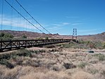
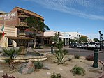
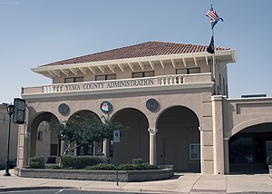
Clockwise from top: Old Yuma City Hall, Ocean to Ocean Bridge, Kofa Mountains, Downtown Yuma, Yuma County administration building, McPhaul Suspension Bridge, Yuma County Courthouse and the Sonoran Desert near Yuma. | |
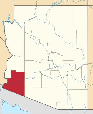
 Location within the U.S. state of Arizona | |
 Arizona's location within the U.S. | |
| Coordinates: 32°47′13″N 113°58′58″W / 32.786944444444°N 113.98277777778°W | |
| Country | |
| State | |
| Founded | November 9, 1864 |
| Named for | Yuma (Quechan) people |
| Seat | Yuma |
| Largest city | Yuma |
| Area | |
• Total | 5,519 sq mi (14,290 km2) |
| • Land | 5,514 sq mi (14,280 km2) |
| • Water | 5.1 sq mi (13 km2) 0.1% |
| Population (2020) | |
• Total | 203,881 |
• Estimate (2023) | 213,221 |
| • Density | 37/sq mi (14/km2) |
| Time zone | UTC−7 (Mountain) |
| Congressional districts | 7th, 9th |
| Website | www |
Yuma County is a county in the southwestern corner of the U.S. state of Arizona. As of the 2020 census, its population was 203,881.[1] The county seat is Yuma.[2]
Yuma County includes the Yuma, Arizona Metropolitan Statistical Area.
The county borders three states: Sonora, Mexico, to the south, and two other states to the west, across the Colorado River: California of the United States and the Mexican state of Baja California.
Being 63.8% Hispanic in 2020, Yuma is Arizona's largest majority-Hispanic county.[3]
- ^ "State & County QuickFacts". United States Census Bureau. Retrieved September 27, 2022.
- ^ "Find a County". National Association of Counties. Archived from the original on May 31, 2011. Retrieved June 7, 2011.
- ^ "2020 Census". 2020 Census. United States Census Bureau. Retrieved September 24, 2021.


