You can help expand this article with text translated from the corresponding article in Greek. (August 2018) Click [show] for important translation instructions.
|
Zagora
Ζαγορά | |
|---|---|
 Zagora | |
| Coordinates: 39°27′N 23°6′E / 39.450°N 23.100°E | |
| Country | Greece |
| Administrative region | Thessaly |
| Regional unit | Magnesia |
| Municipality | Zagora-Mouresi |
| Area | |
| • Municipal unit | 96.1 km2 (37.1 sq mi) |
| Elevation | 458 m (1,503 ft) |
| Population (2021)[1] | |
| • Municipal unit | 2,775 |
| • Municipal unit density | 29/km2 (75/sq mi) |
| • Community | 1,981 |
| Time zone | UTC+2 (EET) |
| • Summer (DST) | UTC+3 (EEST) |
| Postal code | 370 01 |
| Area code(s) | 24260 |
| Vehicle registration | ΒΟ |
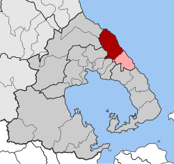
Zagora (Greek: Ζαγορά) is a village and a former municipality on the Pelion peninsula in Magnesia, Thessaly, Greece. Since the 2011 local government reform it is part of the municipality Zagora-Mouresi, of which it is the seat and a municipal unit.[2] The municipal unit has an area of 96.101 km2.[3]
Zagora is an important commercial and touristic center of Pilion with a rich history and cultural traditions. Beyond Zagora, to the north, we find the Palaeolithic settlement of Pouri, and, to the east, the famous seaside resort of Chorefto. The village has many fine examples of architecture typical of Pilion, including its churches and several notable archontika (mansions). Zagora is composed of four districts that correspond to its four main churches: Agios Georgios, Agia Kyriaki, Agia Paraskevi (or Perachora) and Metamorphosis (or Sotira).[4]
- ^ "Αποτελέσματα Απογραφής Πληθυσμού - Κατοικιών 2021, Μόνιμος Πληθυσμός κατά οικισμό" [Results of the 2021 Population - Housing Census, Permanent population by settlement] (in Greek). Hellenic Statistical Authority. 29 March 2024.
- ^ "ΦΕΚ B 1292/2010, Kallikratis reform municipalities" (in Greek). Government Gazette.
- ^ "Population & housing census 2001 (incl. area and average elevation)" (PDF) (in Greek). National Statistical Service of Greece.
- ^ Ζαμπιόγλου, Βαλεντίνα (6 Φεβρουαρίου 2018). «Ζαγορά: Το ιστορικό χωριό του Πηλίου». Maxmag. Αρχειοθετήθηκε από το πρωτότυπο στις 6 Φεβρουαρίου 2018.

