Zahedan Airport زاہدان بالی پَٹ فرودگاه بین المللی زاهدان | |||||||||||
|---|---|---|---|---|---|---|---|---|---|---|---|
| Summary | |||||||||||
| Airport type | Public/military | ||||||||||
| Owner | Government of Iran | ||||||||||
| Operator | Iran Airports Company Islamic Republic of Iran Army Aviation Islamic Revolutionary Guard Corps Iranian Police Aviation | ||||||||||
| Serves | Zahedan, Sistan and Baluchestan | ||||||||||
| Location | Zahedan, Iran | ||||||||||
| Elevation AMSL | 4,564 ft / 1,391 m | ||||||||||
| Coordinates | 29°28′32.47″N 060°54′22.28″E / 29.4756861°N 60.9061889°E | ||||||||||
| Website | zahedan.airport.ir | ||||||||||
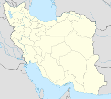
| Map | |||||||||||
 | |||||||||||
| Runways | |||||||||||
| |||||||||||
| Statistics (2017) | |||||||||||
| |||||||||||
Source: Iran Airports Company[1] | |||||||||||
Zahedan Airport (IATA: ZAH, ICAO: OIZH) (Persian: فرودگاه بین المللی زاهدان, Balochi: زاہدان بالی پَٹ) is an international airport located 6 kilometers northeast of the city of Zahedan, in Sistan and Baluchestan Province, southern Iran.[2] The airport has flight connections to different parts of Iran and countries of south of Persian Gulf.
- ^ "Traffic Figures". Retrieved 14 February 2018.
- ^ "List of all airports in Iran". The Airport Authority. Retrieved 2019-01-02.
