This article needs additional citations for verification. (March 2019) |
Zarzal, Valle del Cauca | |
|---|---|
Municipality and city | |
| City of Zarzal, Valle del Cauca | |
 | |
| Nickname(s): "Sweet Land of Colombia", "The Z" | |
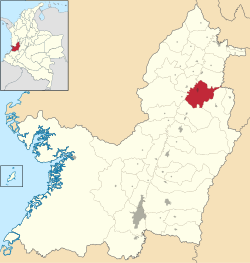
 Location of the town and municipality of Zarzal in Valle del Cauca Department. | |
| Coordinates: 4°23′54″N 76°04′38″W / 4.39833°N 76.07722°W | |
| Country | Colombia |
| Department | Valle del Cauca |
| Region | Andean |
| Demonym | Zarzaleno |
| Foundation | April 1, 1909 |
| Government | |
| • Mayor | María Teresa Giraldo |
| Area | |
• Municipality and city | 367.9 km2 (142.0 sq mi) |
| • Urban | 4.88 km2 (1.88 sq mi) |
| Elevation | 916 m (3,005 ft) |
| Population (2018 census)[1] | |
• Municipality and city | 41,925 |
| • Density | 110/km2 (300/sq mi) |
| • Urban | 31,812 |
| • Urban density | 6,500/km2 (17,000/sq mi) |
| Time zone | UTC-5 |
| Website | www.valledelcauca.gov.co/zarzal |
| * | |
Zarzal (Spanish pronunciation: [saɾˈsal]) is a city and municipality in the north of the department of Valle del Cauca in Colombia. Its economy is based primarily on the extensive cultivation of sugar cane, on small and medium enterprises in the metallurgic sector, and on utilities. Commerce is also of great importance, because a great number of warehouses for basic necessity goods exist in the city. A marketplace also exists, which serves as reference for various cities that are close by. Zarzal municipality has a population of about 42,000. New city districts were constructed in the center of the city; it has now become difficult to find bare land inside the city.


