Zarzir
| |
|---|---|
Local council (from 1997) | |
| Hebrew transcription(s) | |
| • ISO 259 | Zarzir |
| • Also spelled | Bet Zarzir (official) |
 Council headquarters | |
| Coordinates: 32°43′38″N 35°13′29″E / 32.72722°N 35.22472°E | |
| Country | |
| District | Northern |
| Area | |
| • Total | 3,889 dunams (3.889 km2 or 1.502 sq mi) |
| Population (2022)[1] | |
| • Total | 8,565 |
| • Density | 2,200/km2 (5,700/sq mi) |
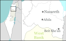
Zarzir (Arabic: زرزير, Hebrew: זַרְזִיר), also known as Beit Zarzir, is an Arab local council located 10 kilometres (6.2 mi) west of the city of Nazareth in the Northern District of Israel. In 2022 it had a population of 8,565,[1] consisting of five Bedouin tribes, Mazarib, Grifat, Haib, Jawamis, and Eyadat.
- ^ a b "Regional Statistics". Israel Central Bureau of Statistics. Retrieved 21 March 2024.
