This article needs additional citations for verification. (December 2014) |
Zirakpur | |
|---|---|
Town | |
 | |
| Coordinates: 30°39′N 76°49′E / 30.65°N 76.82°E | |
| Country | |
| State | Punjab |
| District | Mohali |
| Elevation | 350 m (1,150 ft) |
| Population (2011)[1] | |
| • Total | 95,553 |
| Languages | |
| • Official | Punjabi |
| Time zone | UTC+5:30 (IST) |
| PIN | 140603/140604/160104 |
| Telephone code | +91-1762-XXX XXX |
| Vehicle registration | PB-70 |
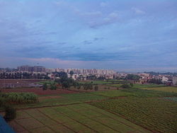
Zirakpur is a planned[2] satellite city, in Mohali District, Punjab, neighboring Mohali, Chandigarh in India. It is set on the foothills of Shivalik hills. It is part of the tehsil Dera Bassi. It is the gateway to Chandigarh from Delhi. It comprises mainly the following areas near Chandigarh Airport including VIP Road, Dhakoli, Lohgarh, Bhabat, Bishanpura, Kishanpura, Nabha, Gazipur, Baltana, Singhpura, Peer Muchalla and Dyalpura. This town is situated on the junction of national highways Himalayan Expressway, National Highway 5 (India) towards Shimla, Ambala Chandigarh Expressway towards Ambala and National Highway 7 (India) towards Patiala.
- ^ "Census of India: Search Details". Archived from the original on 24 September 2015. Retrieved 6 May 2014.
- ^ "Zirakpur (2031) | Greater Mohali Area Development Authority, Government of Punjab, India". www.gmada.gov.in.
