Zuunmod District
Зуунмод сум ᠵᠠᠭᠤᠨᠮᠣᠳᠤᠰᠤᠮᠤ | |
|---|---|
 Zuunmod centre | |
| Coordinates: 47°42′25″N 106°56′58″E / 47.70694°N 106.94944°E | |
| Country | Mongolia |
| Province | Töv Province |
| Area | |
• Total | 19.18 km2 (7.41 sq mi) |
| Elevation | 1,530 m (5,020 ft) |
| Population (2017) | |
• Total | 16,953 |
| • Density | 880/km2 (2,300/sq mi) |
| Time zone | UTC+8 (UTC + 8) |
| Area code | +976 (0) 272 |
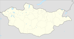
Zuunmod (Mongolian: Зуунмод; ᠵᠠᠭᠤᠨᠮᠣᠳᠤ, "Hundred Trees") is the administrative seat of Mongolia's Töv Province. It has a population of 16,953 (2017) inhabitants and an area of 19.18 square kilometres.[1] Zuunmod is located on the south side of Bogd Khan Mountain, 43 kilometres (27 mi) south of the capital city of Ulaanbaatar. Zuunmod was established as the administrative center of Töv Province in 1942. Until that time, the administration of the aimag had been located in Ulaanbaatar.
The significant Battle of Jao Modo took place here in early May 1649, ending with the victory for the Qing dynasty.
- ^ "Төв аймгийн төв Зуунмод хот нь 1918 га газартай": Töv aimag official site[permanent dead link]
